Which Walking Routes in Dryden Actually Get You Where You Need to Go?

Which Walking Routes in Dryden Actually Get You Where You Need to Go?
Have you ever set out on foot in Dryden only to realize halfway through your walk that the sidewalk ends—or worse, that you've ended up on a stretch of road with no shoulder and traffic moving faster than you'd like? We have a beautiful city for walking, but not all routes are created equal. Whether you're trying to leave the car at home for quick errands, get some exercise without driving to a trailhead, or simply explore our neighborhoods safely, knowing which paths actually connect our community matters.
In Dryden, we're fortunate to have options—though they aren't always obvious. Some of our best walking corridors hide in plain sight, while other streets that look promising on a map turn out to be narrow, uneven, or lacking pedestrian crossings. This isn't about scenic hikes (though we have plenty of those). It's about the practical business of getting from point A to point B on foot—the kind of everyday walking that keeps us connected to our community and reduces the number of cars on our roads.
Where Can You Walk Safely from the Downtown Core?
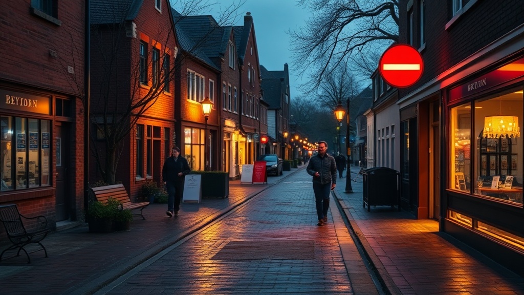
Let's start where many of us find ourselves during the week: downtown Dryden. If you're near the intersection of King Street and Whyte Avenue, you have more options than you might think—provided you head in the right direction.
Heading north on King Street toward the Dryden Memorial Arena and the Thunderbird Mall area is one of our most reliable pedestrian corridors. The sidewalks are continuous, well-maintained, and wide enough for two people to walk abreast without stepping into the boulevard. You'll pass the Dryden Public Library (worth a stop if you haven't been lately), and the crossing at Van Horne Avenue has a proper signalized intersection—something we can't take for granted in a smaller city.
East-west movement downtown is trickier. Whyte Avenue itself has decent sidewalks in the commercial core, but they get patchy as you move toward the residential edges. If you're trying to get from downtown toward the Dryden Regional Health Centre on Grand Trunk Avenue, the most pleasant route isn't the most direct one. Instead of heading straight up Gordon Road (which narrows and loses its sidewalk), take the slightly longer path through the residential streets—north on King, east on St. Charles Street, then south on Earl Avenue. It adds maybe five minutes, but you'll walk on quiet streets with actual sidewalks the entire way.
The stretch of Highway 17 (the Trans-Canada) that runs through our city is, frankly, unpleasant for pedestrians. We've all seen people trying to walk along that corridor, and it's not safe—the traffic moves fast, the shoulder is narrow, and the noise makes conversation impossible. If you need to cross from one side of the highway to the other on foot, use the signalized crossings at King Street or Whyte Avenue. Don't risk the unmarked stretches.
Which Residential Neighborhoods Have the Best Connected Sidewalks?
Dryden's residential neighborhoods vary significantly in walkability, and it often comes down to when they were developed. The older areas—particularly the grid of streets between King Street and St. Charles Street, roughly bounded by Van Horne Avenue and Casimir Avenue—have the most connected sidewalk network. These streets were laid out in an era when walking to school, church, or the corner store was assumed. The sidewalks might be older (watch for frost heaves in spring), but they exist and they connect.
The area around Churchill Drive and McMillan Drive, west of downtown, has seen improvements over the past decade. If you're walking in this neighborhood—perhaps heading to the Dryden High School area or the Superior-Greenstone District School Board office—you'll find that newer sidewalk installations have filled in some of the gaps. The route along Churchill Drive itself is now continuous from Grand Trunk Avenue almost to Colonization Avenue, which makes a significant difference for students walking to school and for residents accessing the nearby ball diamonds.
South of the highway, the walkability picture gets more complicated. The neighborhoods around Edward Street and Thiel Street have sporadic sidewalk coverage—some streets have them, some don't, and the transitions can be abrupt. If you live in this area and walk regularly, you've probably already mapped your preferred routes. For visitors or newer residents: stick to Edward Street itself for the most continuous pedestrian infrastructure, and be prepared for stretches where you'll be walking on the gravel shoulder.
The newer subdivisions on the edges of town—particularly the areas developed in the 2000s and later—tend to have sidewalks on the main collector roads but not on the interior residential streets. This is a pattern we see in many Canadian cities, and it's frustrating. You can walk safely along the perimeter, but getting from one cul-de-sac to another on foot often means walking in the street. If you're house-hunting in Dryden and walkability matters to you (and it should), pay attention to this.
How Do You Connect to Our Parks and Trails Without Driving?
Here's where Dryden shines—and where we have opportunities we're not fully using. Our city has excellent natural areas for walking, but getting to them on foot from residential neighborhoods isn't always straightforward.
The Dryden Walking Trail (also known as the Safarik Trail in sections) is our premier multi-use path. It runs roughly parallel to the Wabigoon River, connecting several neighborhoods to recreational areas. If you can access this trail from your starting point, you're in good shape—it offers a separated, off-road surface that's suitable for walking, jogging, and cycling. The challenge is getting to the trailhead.
From the downtown area, you can access the trail near the arena complex or from the parking area near the dog park on Duke Road. If you're coming from the residential areas south of the highway, your best bet is the connector near the intersection of Edward Street and Duke Road—though you'll need to navigate some unsidewalked sections to get there. The City of Dryden's Recreation and Parks page has a map of the trail system that's worth consulting before you head out.
The Dryden Ski Hill area isn't just for winter. In summer and fall, the service roads and trails around the hill offer excellent walking terrain with views you can't get elsewhere. But here's the thing: there's no safe way to walk there from town. None. Highway 17 has no shoulder suitable for pedestrians in that stretch, and the side roads that connect are either private or unsuitable for walking. Until we have a proper trail connection (something the City of Dryden has discussed but not funded), this excellent recreational resource is essentially car-dependent. That's a missed opportunity for our community.
Closer to home, most of our neighborhood parks—like the ones near New Prospect School or the playground areas in the Churchill Drive neighborhood—are accessible via residential streets. You won't find dedicated walking paths to them, but the traffic volumes are low enough that walking in the street or on the boulevard feels reasonable. Use your judgment, wear something visible, and assume drivers aren't expecting pedestrians.
What About Walking for Errands—Can You Really Get Things Done on Foot?
This is the test of a truly walkable community: not just walking for recreation, but walking to accomplish daily tasks. In Dryden, the answer is a qualified yes.
If you live within the central area bounded roughly by King Street, Van Horne Avenue, and the highway, you can handle a surprising number of errands on foot. The Thunderbird Mall area (with groceries, the post office, banking, and pharmacy options) is reachable from most of downtown via the King Street corridor. The Dryden Farmers' Market operates seasonally in this general area too—though you'd want to check current locations as they've moved between several sites in recent years.
The City Hall complex on Van Horne Avenue is accessible on foot from much of the city, and this matters more than you might think. If you've ever needed to pick up a permit, pay a utility bill, or attend a council meeting, being able to walk there removes one barrier to civic participation. The same goes for the Dryden Public Library—a true community hub that serves as a destination for walking trips, especially for families with children.
What's missing? A genuinely walkable commercial mix in our residential neighborhoods. The corner store—the kind of place where you could pick up milk, bread, or a newspaper within a five-minute walk of home—is largely absent from Dryden's development pattern. We have excellent businesses concentrated in our commercial core, but that concentration means most of us need to travel farther for basic needs. It's a trade-off that favors a vibrant downtown (which we have) over neighborhood convenience (which we largely don't).
How Can We Make Dryden More Walkable?
This isn't just a rhetorical question—there are concrete things we can do as residents to improve walking conditions in Dryden, and there are policy choices the city could make.
As walkers, we can be more visible and predictable. Wear bright clothing, especially during our long winter evenings. Use crosswalks where they exist—even if it means walking slightly out of your way—because every pedestrian using the designated crossing makes the case for more infrastructure. Report sidewalk maintenance issues to the city; they can't fix problems they don't know about.
On the policy side, Dryden could prioritize "infill" sidewalk projects that connect existing segments rather than building new roads. Every gap in the sidewalk network forces pedestrians into conflict with vehicles, and filling those gaps is usually cheaper than new construction. The city could also require sidewalks in all new subdivisions (surprisingly, this isn't always the case) and could improve trail connections between neighborhoods and recreational areas.
The Ontario Ministry of Transportation has guidelines for pedestrian infrastructure that smaller municipalities can adopt, and there are grant programs available for active transportation projects. Our city staff and council are aware of these opportunities, but they need to hear from residents that walkability is a priority.
Walking in Dryden isn't just about exercise or recreation—it's about belonging to a community where you can encounter your neighbors, support local businesses without the hassle of parking, and move through your day with a little less reliance on a vehicle. Our city has the bones of a walkable community. With some attention to the gaps—infrastructure, policy, and habit—we could be a place where choosing to walk isn't the alternative option but the obvious one.